North Atlantic
August 2014 Tropical Cyclone Counts
| Storm Type | August 2014 | August 1981-2010 Average | Record Most for August Period of Record: 1851-2014 |
|---|---|---|---|
| Tropical Storm (Winds > 39 mph) |
2 | 3.3 |
8 (2004) |
| Hurricane (Winds > 74 mph) |
2 | 1.6 |
5 (1893, 1995, 2004) |
| Major Hurricane (Winds > 111 mph) |
0 | 0.7 | 3 (1886, 1893, 1950, 2004) |
August 2014 Individual Tropical Cyclones
| Name | Dates of winds >39 mph |
Maximum Sustained Winds |
Minimum Central Pressure |
Landfall |
|---|---|---|---|---|
| Hurricane Bertha | August 1st – 6th | 80 mph | 998 mb | N/A |
| Hurricane Cristobal | August 23rd – 29th | 85 mph | 970 mb | N/A |
East Pacific
August 2014 Tropical Cyclone Counts
| Storm Type | August 2014 | August 1981-2010 Average | Record Most for August Period of Record: 1949-2014 |
|---|---|---|---|
| Tropical Storm (Winds > 39 mph) |
6 | 4.2 | 8 (1968) |
| Hurricane (Winds > 74 mph) |
6 | 2.2 |
6 (1972) |
| Major Hurricane (Winds > 111 mph) |
3 | 1.1 |
4 (1972, 1993) |
August 2014 Individual Tropical Cyclones
| Name | Dates of winds >39 mph |
Maximum Sustained Winds |
Minimum Central Pressure |
Landfall |
|---|---|---|---|---|
| Hurricane Genevieve | July 25th – August 7th | 135 mph | 960 mb | N/A |
| Hurricane Iselle | July 31th – August 9th | 140 mph | 947 mb | Landfall on August 7th on the Big Island of Hawaii. |
| Hurricane Julio | August 4th – August 15 th | 120 mph | 962 mb | N/A |
| Hurricane Karina | August 13th – August 27th | 80 mph | 988 mb | N/A |
| Hurricane Lowell | August 18th – August 24th | 75 mph | 982 mb | N/A |
| Hurricane Marie | August 22nd – 29th | 160 mph | 918 mb | N/A |
Significant Events
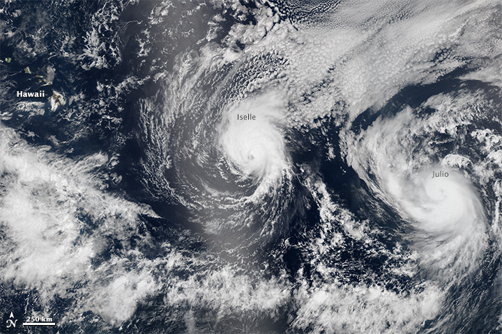
Hurricane Iselle formed off the west coast of Mexico on July 31st as a tropical storm in the middle of the East Pacific Basin. The storm moved westward and strengthened over the next week. The storm reached peak intensity on August 4th, with sustained winds of 140 mph (Category 4) and a central minimum pressure of 947 mb. The storm continued its westward movement towards the Hawaiian Islands and slowly weakened. Iselle made landfall on Hawaii's Big Island on August 7th as a tropical storm with sustained winds of 60 mph. Iselle was the strongest tropical cyclone on record to make landfall on the Big Island and was the first tropical cyclone to make landfall anywhere in Hawaii since Hurricane Iniki in 1992. Iselle was also only the second tropical storm strength cyclone to directly impact the Big Island. As Iselle moved through the archipelago, tropical storm-force winds impacted much of the state, with hurricane force winds measured atop Mauna Kea (13,800 feet elevation). The largest impacts from the storm included strong winds, heavy rainfall, and high surf. Some locations, in orographically enhanced regions, received over a foot of rain causing flooding and road washouts. Over 21,000 homes and business lost power due to downed trees. One fatality was reported due to the high flood waters. Significant damage was also reported to agricultural crops including coffee, macadamia trees, and papayas. After the storm moved through the islands, unfavorable environmental conditions and the interaction with the high terrain caused Iselle to quickly dissipate by August 9th. As Iselle was tracking through Hawaii, the islands were also threatened by Hurricane Julio. Hurricane Julio ultimately passed north of Hawaii generating heavy surf along the northern coasts. This marked the first time on record that two simultaneous tropical cyclones threatened the state at the same time.
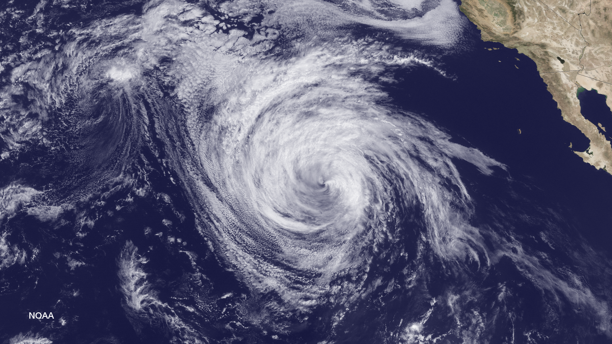
Tropical Storm Marie formed off the western coast of Central America on August 22nd. The storm moved northwesterly, parallel to the coast of Mexico over the next week reaching Category 5 strength on August 24th with sustained winds of 160 mph and a central minimum pressure of 918 mb. This was the strongest, and the only Category 5, tropical cyclone of the 2014 East Pacific season to date. Marie was also a large storm, with tropical storm force winds extending over 250 miles from the center. The largest impacts of Marie were the heavy surf and strong waves it generated from the Baja Peninsula in Mexico, northward to Southern California. Waves up to 20 feet were generated at beaches near Los Angeles, causing significant coastal erosion and damage to piers and coastal property. This was the largest high surf event for that region of California since July 1996.