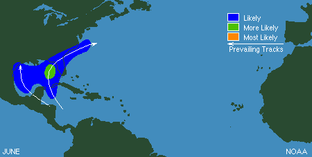
Atlantic Basin
Early season storms (those occurring in June) have a greater likelihood of developing in the Gulf of Mexico than in the rest of the tropical Atlantic. Before 2005, there have been only 12 occasions since 1851 when two or more tropical storms have formed in June.

The image to the left, taken on June 10th, shows rainfall associated with Tropical Storm Arlene as measured by NASA's Tropical Rainfall Measurement Mission (TRMM) satellite. A tropical depression developed on June 8th and became Tropical Storm Arlene, the first named storm of the 2005 Atlantic season, on June 9th about 170 miles west-southwest of Grand Cayman. Arlene crossed the western tip of Cuba with winds of around 50 mph. After entering the Gulf of Mexico, Arlene reached peak winds of around 70 mph (near hurricane strength) in the eastern Gulf of Mexico before weakening prior to landfall near Pensacola, Florida on the 11th. Sustained winds at landfall were approximately 60 mph and Arlene caused little damage. The storm was absorbed by a frontal system on the 14th over southeastern Canada.
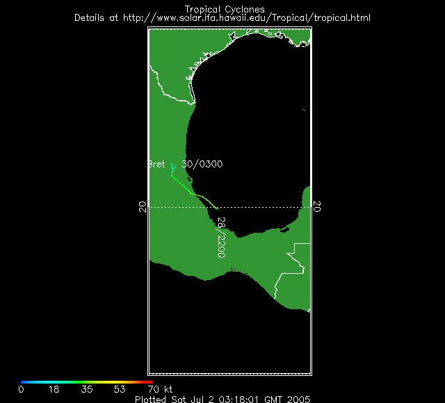
Tropical Storm Bret was a weak tropical storm that formed from an area of disturbed weather on the 28th in the Bay of Campeche. The storm moved west-northwestward and made landfall on the 29th near Tuxpan, Mexico with maximum sustained winds of around 40 mph. Rainfall associated with Bret led to flooding in the state of Veracruz.
Accumulated Cyclone Energy (ACE) indices are available for Arlene and Bret
Pacific Basin
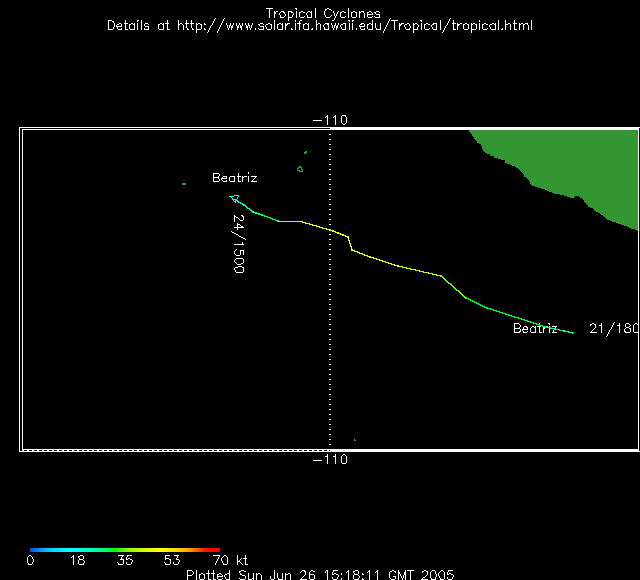
There were no hurricanes in June in the East Pacific, though two tropical storms formed during the month. Beatriz was a depression on June 21st about 275 miles south of Zihuatanejo, Mexico. As the storm moved west-northwest away from the coast of Mexico, it strengthened become a tropical storm on the 22nd. Beatriz reached maximum sustained winds of 45 kts on the 23rd before weakening to a depression on the 24th due to increased wind shear and cooler sea-surface temperatures.
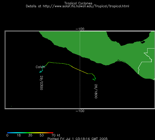
Calvin was a tropical depression on June 26th about 250 miles south of Acapulco. On the 27th, Calvin became a tropical storm and reached 45 kts, its peak intensity, the same day. Similar to Beatriz, wind shear weakened the storm and it became a depression on the 28th.