Note: This report catalogs recent tropical cyclones across the North Atlantic and East Pacific and places each basin’s tropical cyclone activity in a climate-scale context. It is not updated in real time. Users seeking the real time status and forecasts of tropical cyclones should visit The National Hurricane Center.
Atlantic Basin
 larger image |
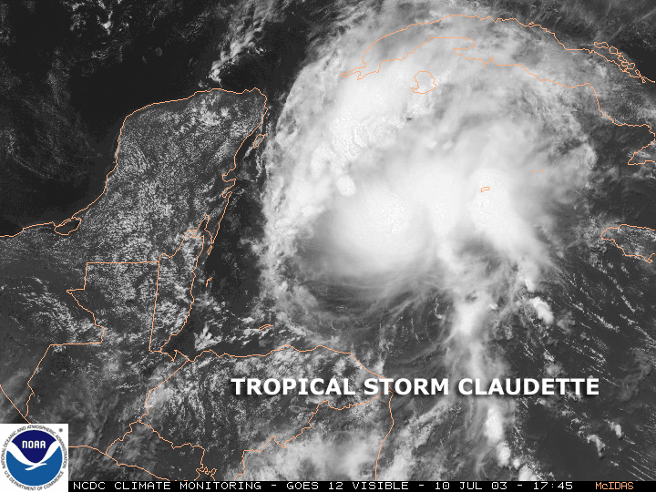
Tropical Storm Claudette
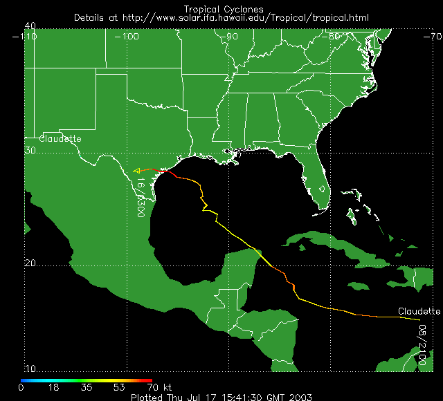
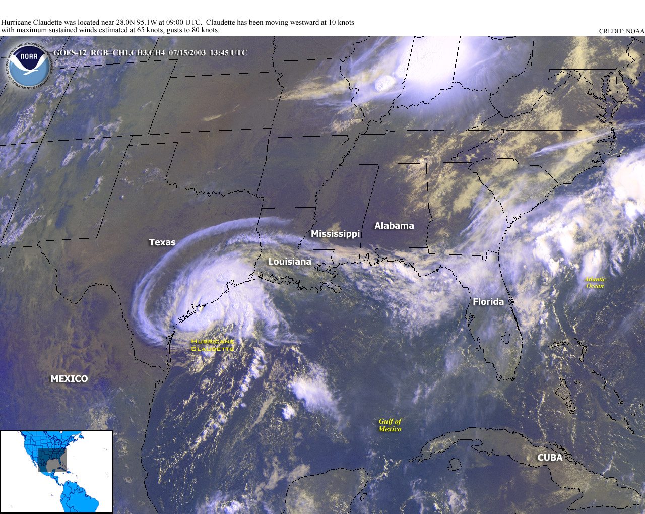
developed in the central Caribbean Sea on July 8th about 415 miles (670 km) east-southeast of Kingston, Jamaica. The storm strengthened and moved rapidly across the Caribbean Sea during the following 24 hours. Claudette maintained strength and moved west and then northwest before weakening as it entered the Gulf of Mexico, clipping the Yucatan coast of Mexico. It then moved very slowly through the Gulf of Mexico over the weekend of the 12th and 13th while gradually strengthening to reach category 1 hurricane strength late on July 14th. The first Atlantic hurricane of the season, Hurricane Claudette finally made landfall on the morning of July 15th around Port O'Connor, Texas, with maximum sustained winds at around 75 mph (120 kph/65 kts).
|
| The storm left two Texas residents dead and thousands without power along the central Texas coast before being downgraded to a tropical depression on the 16th. However, Claudette also brought welcome moisture to parts of Texas and the Southwest which had been dry. |
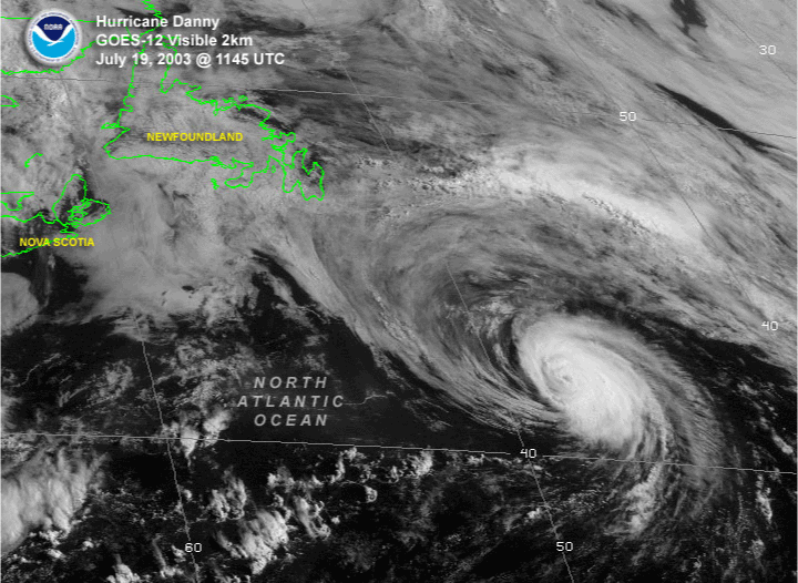
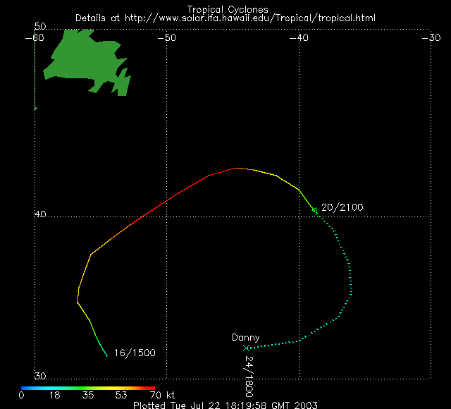
| Hurricane Danny began east of Bermuda as Tropical Depression #5 on July 16th and rapidly developed into a tropical storm later the same day. While posing no threat to land, Danny moved northward and then northeastward and became the second hurricane of the season on July 18th. Hurricane Danny weakened back to tropical storm status on the 19th as it tracked east-southeast across the North Atlantic. Tropical Depressions #6 and #7 also formed during July, but neither one was long-lived. TD #6 formed on the 19th and degenerated into a tropical wave by the 21st. Some thunderstorm activity was observed over the Lesser Antilles as a result of this system. TD #7 formed on July 25 and came ashore in Georgia on the 26th. Sustained winds were at 30 mph (48 kph/26 kts) at landfall and 2-3 inches (51-76 mm) of rain fell in parts of Georgia and South Carolina from the tropical system. |
 larger image |
Pacific Basin
 larger image |
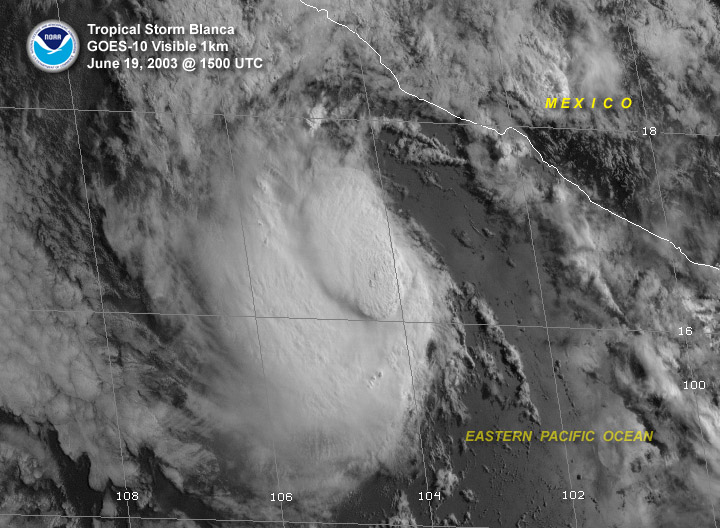
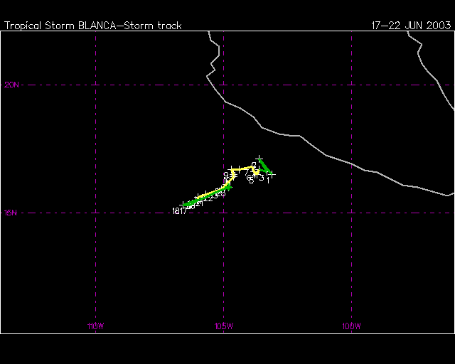
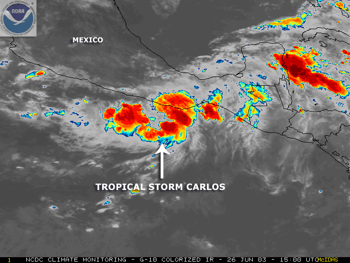
The second and third tropical storms of the season in the eastern North Pacific formed during June. Tropical Storm Blanca formed about 260 miles south-southeast of Manzanillo, Mexico and reached maximum windspeeds of 55 knots (63 mph) on June 18. Blanca did not move far from its point of origin and never threatened land. T.S. Carlos came ashore near Puerto Escondido on June 27 as a 55 kt (63 mph) tropical storm. It had formed on June 25 about 200 miles south-southeast of Acapulco. After making landfall, Carlos quickly dissipated.
|