Note: This report catalogs recent tropical cyclones across the North Atlantic and East Pacific and places each basin’s tropical cyclone activity in a climate-scale context. It is not updated in real time. Users seeking the real time status and forecasts of tropical cyclones should visit The National Hurricane Center.
 larger image |
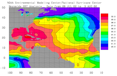
The map to the left shows sea-surface temperatures for the Atlantic averaged over the week of July 28th-August 3rd. Although much of the Gulf of Mexico and the Caribbean have sufficiently warm waters to support tropical storm development, much of the tropical Atlantic is at or below average for this time of year. As a consequence of this and a developing El Nino, scientists at NOAA's Climate Prediction Center have revised the seasonal prediction of Atlantic tropical storm activity. They are predicting that there will be 7-10 tropical storms this year (compared to 9-13 in the original outlook) of which 4-6 could develop into hurricanes and 1-3 of these hurricanes could be 'major' (category 3 or higher on the Saffir-Simpson Scale).
|
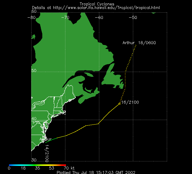
| On average, 2 tropical storms will have formed in the Atlantic Basin by the end of July. July 2002 saw the development of Tropical Storm Arthur (shown in the satellite image to the right) which began as a tropical depression off the coast of North Carolina on July 14th and tracked northeastward becoming a tropical storm by the 16th with maximum sustained winds of 60 mph. Arthur never threatened land and there was no associated damage or death. | 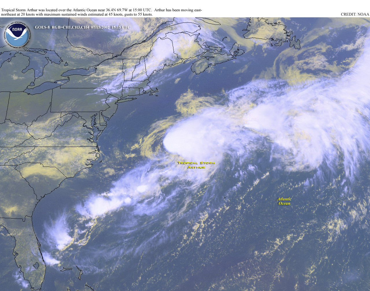 larger image |