This will be the last U.S. snow report until October 2013
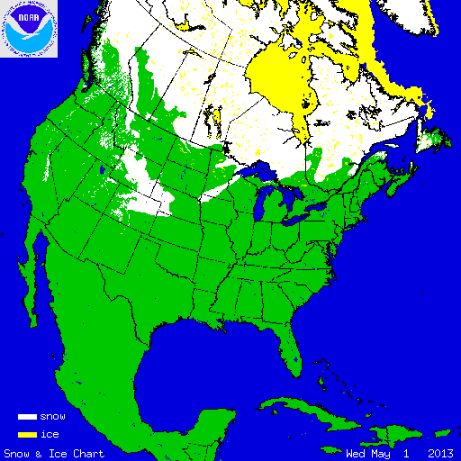
During May, most of the northern U.S. was wetter and warmer than average. The warmer than average temperatures caused most of the precipitation to fall as rain and not snow, with the exception of a few unusual late-season snow storms. An early-May storm that moved through the central part of the nation brought snowfall from Colorado to Wisconsin and southward to parts of Arkansas. A late-May storm brought snow exceeding 20 inches to the high elevations of the Northeast. The western U.S. had below-average snow cover for most of the month. According to NOAA's National Snow Analysis, at the beginning of May, 7.6 percent of the nation had snow on the ground — the highest elevations of the West, parts of the Upper Midwest, and mountain locations in the Northeast. Snow coverage peaked on May 2nd, when 11.6 percent of the contiguous U.S. was snow covered. By May 31st, 1.5 percent of the nation had snow on the ground — parts of the Northern Rockies and the Cascades.

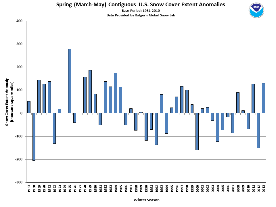
According to data from the Rutgers Global Snow Lab, the monthly snow cover extent across the contiguous U.S. during May was 6,564 square miles, 56,757 square miles below the 1981-2010 average. This was the second smallest May snow cover extent on record. Only May 2004 had less observed snow cover. Parts of the north-central U.S. had above-average snow cover during May, while most of the western U.S. had much-below average snow coverage. Despite the below-average May snow cover, the above-average snow cover in March and April was enough for the spring (March-May) snow cover extent to be 130,090 square miles above the 1981-2010 average of 355,500 square miles and the eighth largest spring snow cover extent on record. The above-average spring snowfall in many locations exceeded the amount of snow that was observed during the preceding winter season. A select list of those locations is available here.
Summary of Notable Snow Events:

A strong storm brought late-season snowfall on May 1st–3rd from the Rockies, through the Central Plains, and into the Mississippi River Valley. Locations as far south as Arkansas received measureable snowfall. Ahead of the storm system, temperatures surged into the mid and upper 80s in the Upper Midwest. Behind the system, cold Arctic air filtered into the central United States, allowing precipitation to fall mostly as snow. The cold, Arctic air broke temperature records for this late in the spring season. Denver, Colorado dipped to 19°F on May 2nd, tying the record coldest temperature observed during the month of May. The highest snowfall totals occurred across the Rockies and the Upper Midwest, where snowfall exceeded 20 inches in parts of Colorado and Wyoming as well as northern Wisconsin. Many locations in the storm's track broke daily, 2-day, and monthly snowfall totals during the event.
Select snowfall records from the May 1st – 3rd, based on preliminary data from the National Weather Service:
- Eau Claire, WI: 2-day snowfall of 9.3 inches on May 2nd – 3rd. This broke the 2-day snowfall record for May and exceeded the monthly average snowfall for the city.
- Decatur, AR: Storm total of 5.0 inches of snow. First snow ever observed in Arkansas during month of May and latest snowfall on record for the state.
- St. Cloud, MN: 2-day snowfall of 3.3 inches on May 2nd – 3rd was a record 2-day May snowfall.
- Omaha, NE: 2-day snowfall of 3.1 inches on May 1st–2nd was a record 2-day May snowfall and record monthly snowfall total.
- Lincoln, NE: 2-day snowfall of 2.7 inches on May 1 st–2nd was the second largest May snow event.
- Osage, IA: Storm total snowfall of 13.0 inches. Highest May snowfall total for Iowa and first May snow storm to produce more than one foot of snow in the state.
- Des Moines, IA: Storm total snowfall of 6.9 inches was the largest May snowfall and a monthly record snowfall.
- Kansas City, MO: Trace of snow on May 3rd was the latest date of observed snowfall in city.
- Tulsa, OK: Trace of snow on May 2nd was the latest date of observed snowfall and first snow observed in May.
- Rochester, MN: Storm total snowfall of 7 inches marked the largest May snowstorm for the city.
- Twin Cities, MN: 0.5 inch accumulated on May 3rd, the 8th highest daily snowfall for month of May.
- Topeka, KS: Trace snowfall on May 2nd, only 3rd occurrence of May snowfall.
A late-season snow storm impacted the high elevations of Upstate New York, Vermont, and New Hampshire on May 24th–26th. The storm system dropped over two feet of snow in the highest elevations with lower amounts observed in the valleys. Binghamton and Syracuse, New York both observed snow showers (only trace accumulation), marking the latest snowfall on record for those cities. Although snowfall this time of year is unusual, particularly for the lower elevations, late-May snowfall for the high elevations in the region has been observed in the past.