Overview:
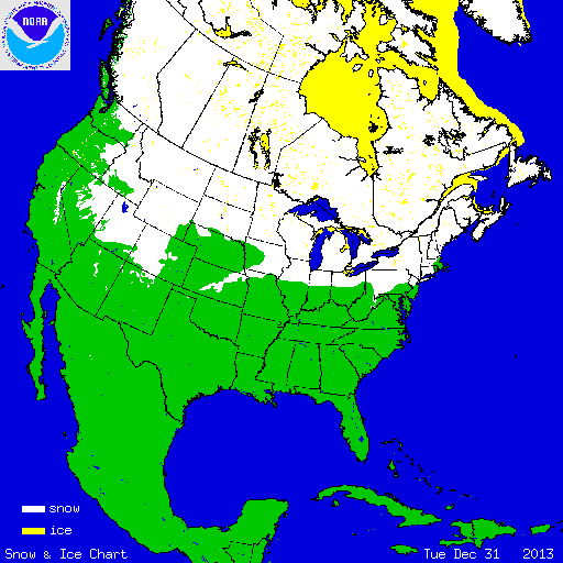
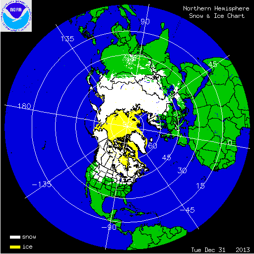
During December, numerous storm systems impacted the contiguous United States, bringing rain and heavy snowfall. According to NOAA's National Snow Analysis, at the beginning of December, 20.2 percent of the contiguous U.S. had snow on the ground — the high terrain of the Intermountain West, along the U.S.–Canadian border, interior regions of the Northeast, and the Central Appalachians. Monthly snow cover peaked on December 9th, when 66.9 percent of the Lower-48 had snow on the ground. By the end of December, 36.2 percent of the contiguous U.S. was snow covered — much of the Intermountain West, Northern Plains, Midwest, interior regions of the Northeast, and northern New England.

According to data form the Rutgers Global Snow Lab, the December snow cover extent for the contiguous U.S. was 1.5 million square miles, which was 317,000 square miles above the 1981-2010 average. This ranked as the eighth largest December snow cover extent on record, and the largest since December 2009. Above-average snow cover was observed for much of the contiguous United States, including the Intermountain West, much of the Great Plains, Midwest, and Northeast. Below-average snow cover was observed across the Mid-Atlantic, Southern Rockies, and Far West.
Summary of Notable Snow Events:
A large winter storm moved through the central United States between December 2–9. The storm dropped heavy snow across the Central Rockies, the Northern Plains and Rockies, and Upper Midwest and lighter snowfall was observed across the Southern Plains and Ohio Valley. Over 18 inches of snow was observed in parts of Colorado and Minnesota. Duluth, Minnesota received 23.3 inches of snow on December 2-4, which was the sixth highest 3-day snowfall accumulation for the city. The storm contributed to 39.9 inches of snow accumulating for the month in Duluth, marking the third highest December snowfall total behind December 1996 and 1950. Two Harbors, MN received 35.3 inches of snow. Nearly a foot of snow fell in southern Missouri, Illinois, and Indiana. Heavy ice accumulations were observed across parts of Texas, Oklahoma, and Arkansas. Fort Worth, TX received 1.5 inches of ice. At least 200,000 people in Texas lost power due to the ice event. By the time the storm ended, on December 9th, 66.9 percent of the contiguous U.S. had snow on the ground.
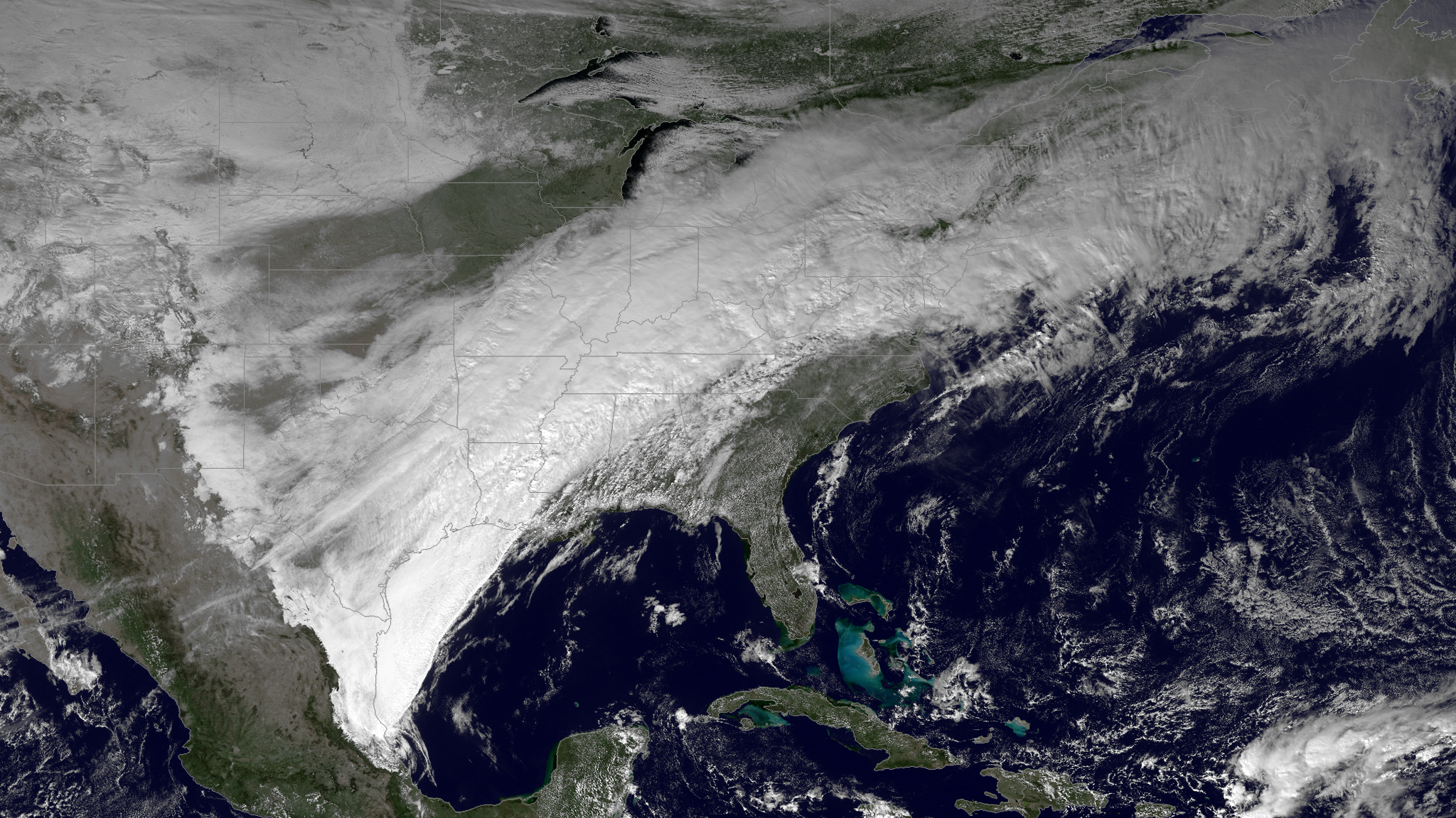
A winter storm impacted the Midwest and Northeast between December 13–16. Over six inches of snow accumulation was reported from Missouri to Maine. The highest snowfall totals, over 18 inches, were reported across the highest elevations of the Adirondack Mountains of New York. The storm received an initial rating of a Category 2, or Significant, on the Northeast Snowfall Impact Scale (NESIS). Most of the snow missed the major population centers of the coastal Northeast. Some minor travel issues were reported across the Northeast.