Overview:
During October, several cold fronts moved through the Northern Plains and Rockies, providing the first seasonal snowfall across the region. A Pacific storm near mid-month dropped several feet of snow across the highest elevations of the Sierra Nevada Mountains, giving an early start to the snow season. The remnants of Hurricane Sandy brought record-breaking, early season snowfall along the highest elevations of the Appalachian Mountains at the end of the month.

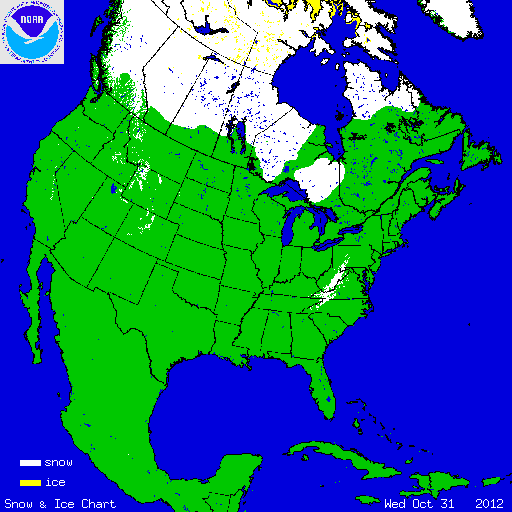
At the beginning of October, snow covered zero percent of the contiguous United States. By the 26th, the snow cover expanded to a monthly maximum of 20.3 percent. On October 31st, snow was on the ground for 4.5 percent of the country — across the highest terrain in the West, in northern Minnesota, and along the Central and Southern Appalachians. For the month as a whole, the contiguous U.S. experienced below-average snow cover extent, according to Rutgers Global Snow Lab. The October monthly snow cover extent was 22,000 square miles (57,000 square km), 48,680 square miles (126,090 square km) below hte 1981-2010 average, and the 15th smallest October snow cover extent in the 45-year period of record. Below-average snow cover was observed across the Intermountain West, while above-average October snow cover occurred across the Central and Southern Appalachians.
Summary of Notable Snow Events:

Sandy remnant-low snowfall totals
The remnant low pressure system from Hurricane Sandy dropped copious amounts of snow across the Southern and Central Appalachians as it moved westward after making landfall near Atlantic City, New Jersey on October 29th. Over a foot of snow was reported in six states from North Carolina to Pennsylvania, shattering October monthly snowfall records. Widespread, heavy snow of this magnitude during October has never been observed across this region. The largest snow totals occurred along the highest elevations of the Appalachians, with Mount Leconte, Tennessee receiving 33 inches of snow and Terra Alta, West Virginia measuring 36 inches. Very strong winds combined with the snow to create blizzard conditions for up to two days in some locations. The largest impacts of the storm were the massive power outages due to downed trees and power lines and building collapses because of the heavy, wet nature of the snow. Flooding was also a concern as warm temperatures returned quickly after the storm causing rapid melt and runoff.