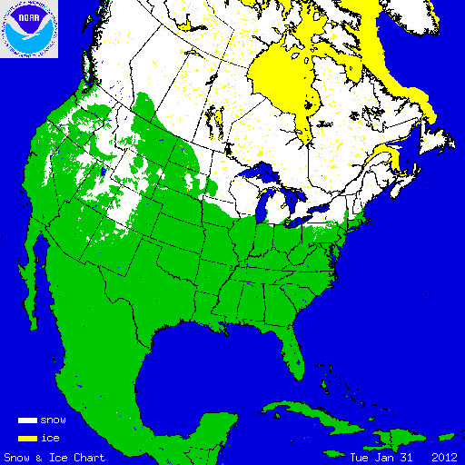
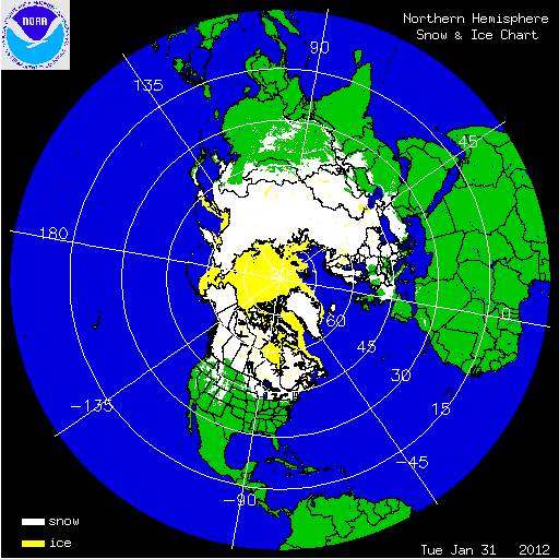
During January, the weather pattern brought above-average temperatures and below-average precipitation to most of the United States. Besides one major winter storm, which impacted the western states, much of the nation had below-average snow during January. The Intermountain West, as well as the Plains, Upper Midwest and Western Great Lakes were particularly warm during January, while most of the Plains and Northeast were drier than normal. These conditions limited snow during most of the month. See the U.S. temperature and precipitation discussion for more information. The major story of January 2012 was the lack of snow, which is in great contrast to the past two Januarys (2011 and 2010) when much-above-average snow was observed for many locations across the country. On January 1st, 19.8 percent of the contiguous U.S. was snow covered — parts of the Northeast, the Western Great Lakes, stretching into the eastern Northern Plains, high elevations of the Central and Northern Rockies, and along the Cascades and Sierra Nevadas. The monthly snow cover peaked on January 23rd, when 42.6 percent of the nation was under snow cover. Warmer-than-average conditions the last week of the month shrank the snow coverage to 23.2 percent of the Lower-48 — most of the Northeast, Great Lakes, the eastern Northern Plains, and the highest terrain of the West.

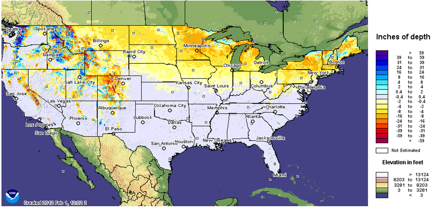
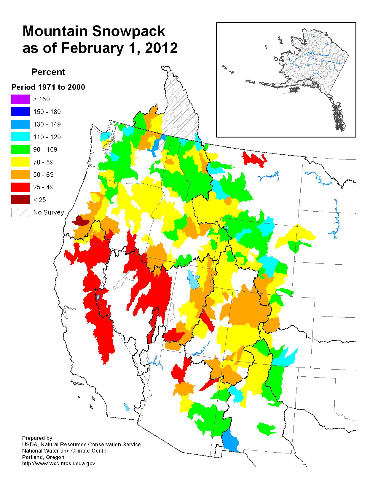
According to data from the U.S. Department of Agriculture (USDA), snowpack totals across the West were mixed. Near to slightly above normal snowpack was reported across the Northwest and Northern Rockies, where a large storm impacted the region. The rest of the West had below-normal snowpacks, especially the Sierra Nevadas, the Great Basin, and parts of the Southern Rockies. According to data from the Rutgers Global Snow Lab, the snow cover extent for the contiguous U.S. during January was much-below average at 1.0 million square miles, which was 329,000 square miles below the 1981-2010 average. Snow cover extent was below average across the Northern Plains, Midwest, and Northeast. The January snow cover extent was the 3rd smallest in the 46-year period of record.
Summary of Notable Snow Events:

A large and powerful winter storm, accompanied by a surge of moisture from the tropics often referred to as an atmospheric river or the 'Pineapple Express', impacted the western U.S. January 18th–23rd. The worst impacts were felt across the Pacific Northwest, where several feet of snow accumulated and strong winds were observed, causing icy roads, downed power lines, and avalanches. A state of emergency was declared for much of Oregon and Washington, where over a quarter-million households lost electricity. Impressive wind, snow, and rain measurements were made during the event — Mount Hood, Oregon received over 50 inches of snow, winds approaching 90 mph were measured at Summer Lake, Oregon, and over 15 inches of rain fell at Swiss Home, Oregon. The Mary’s River in Philomath, Oregon crested at its highest flood height on record. Seven inches of snow fell in Seattle, which averages only 8 inches of snow a year. To the south, across the high terrain of California and Nevada, the precipitation was a welcome sight, where very dry conditions had previously dominated during the 2011-2012 winter season. Nevada’s Carson River Basin had snowpack only 8 percent of normal before the storm (compared to 224 percent last year at this time).