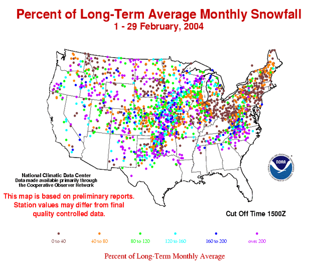
The map to the right shows departures from normal (in percent) for February snowfall totals across the US. The Northeast received much less snow than normal for the month while areas of the Midwest and the Southeast had above average snowfall. However, seasonal snowfall departures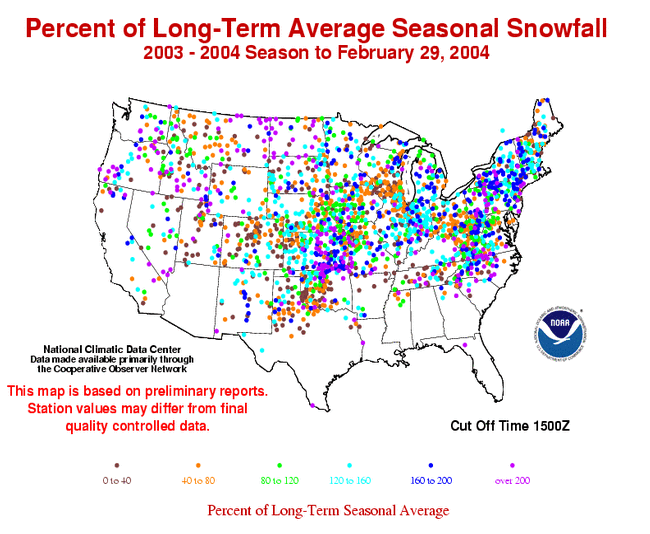 show that snow totals across the Northeast relative to the long-term mean were above average, with less than average seasonal snow amounts being confined to the southern Wisconsin area and the High Plains spreading into the Rocky Mountains and southeastern Oklahoma.
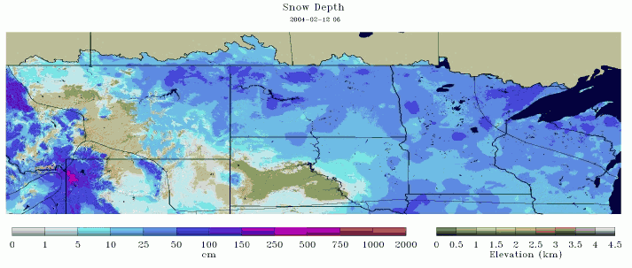
The image to the left shows the snow depth on February 12th, 2004, after a blizzard on the 11th left parts North Dakota with 20 foot drifts of snow. The blizzard conditions, created by heavy snow and gusts of up to 70 mph, prompted the governor of North Dakota to declare a snow emergency. The monthly total snowfall record was also broken for Pocotello, ID in February. A total of 30.5 inches fell during the month breaking the old record by over 7 inches.
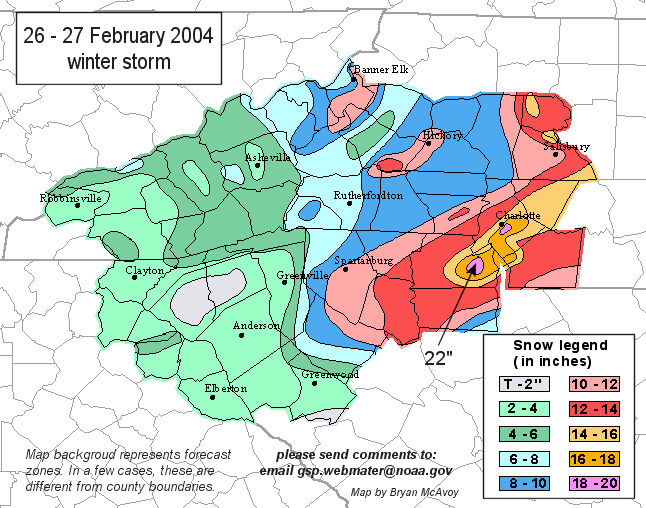
Parts of North and South Carolina also received heavy snow in February with near record amounts falling in the Charlotte Metropolitan area on the 26th. It was Charlotte's third largest snow storm on record for a calendar day, with 11.6 inches observed at the airport and up to 20 inches recorded elsewhere in and around the city.
See NCDC's snow monitoring page for the latest snow totals and the snow climatology pages for snow statistics for U.S.states and stations.