Updated: 15 January 2013
Overview
Wildfire activity was generally light throughout the country during December. Isolated incidents of large fires occurred in the West while scattered activity continued along the Appalachian Mountains in the East during the first half of the month. Large fire activity flared in eastern Oklahoma during the latter half of December.
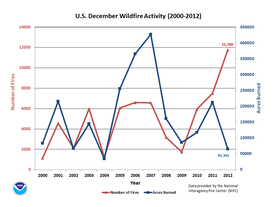
Although the number of fires rose dramatically for the month, the average fire size in December became extremely small because the amount of acres burned stayed relatively low. December's reversal (many fires of small size) was not enough to overturn the year-to-date pattern for incidents of fewer fires with larger size. The monthly total number of 11,760 fires was the most for December in the thirteen-year record and over 2.5 times the 10-year average (based on 2001-2010). Nonetheless, the year-to-date total of 67,265 fires was the 4th least since 2000 for any January through December period.
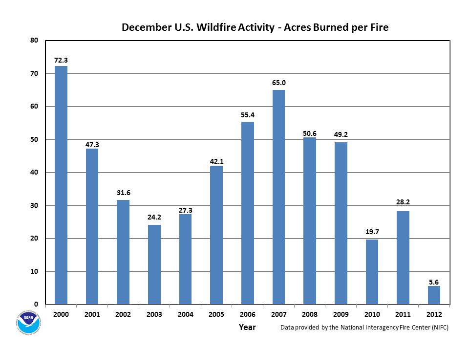
The monthly average fire size of 5.6 acres per fire was the least on record for any December in the 2000-2012 record and far below the 10-year average of 41.2 acres per fire. Yet, the year-to-date average fire size of 137.1 acres was the most since 2000 for any January through December period, and about 1.5 times the 10-year average (based on 2001-2010). The December acres burned represented about one-third of the month's 10-year average (based on 2001-2010) acres burned. The monthly total of 65,361 acres burned by wildfires ranked at the 2nd least amount for any December since 2000. Yet, the year-to-date total acreage burned of 9.2 million acres was the 3rd most since 2000 and represented about 1.5 times the 10-year average (based on 2001-2010).
According to the National Interagency Fire Center (NIFC) :
For more wildfire statistics visit U.S. Wildfires.
Discussion
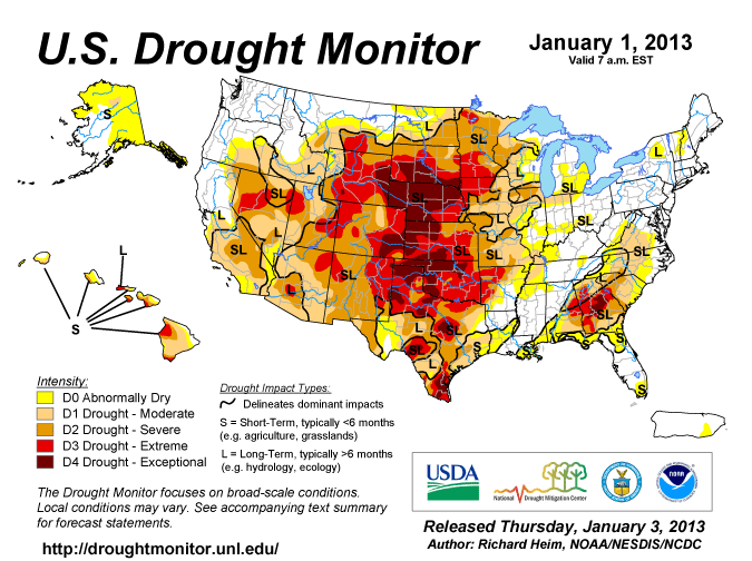
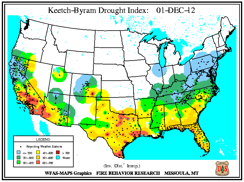
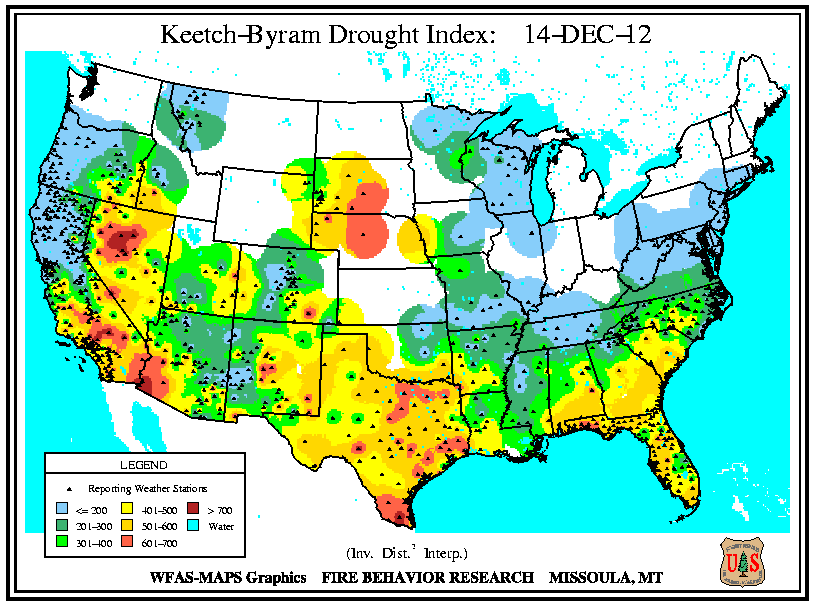
Despite the multiple passages of winter storms across the country throughout December, the precipitation received was not enough to ease long-term deficits. Exceptional drought remained entrenched over the central Great Plains, keeping the wildland fire potential high for the states of Nebraska, Wyoming, Colorado, Kansas, Oklahoma, Texas, and New Mexico. Drought expanded in eastern Wyoming, central Oklahoma, and parts of Texas. At mid-month, precipitation across northern California, Idaho, and northwestern Wyoming brought about improved conditions. In the latter part of December, rains in the Southeast resulted in a lessening of the drought in central Alabama and northern Georgia. Dryness contracted in upstate New York by month's end as beneficial rains fell in the Northeast.
Significant Events
Please note, this is a list of select fires that occurred during December. Additional fire information can be found through Inciweb.
Oklahoma
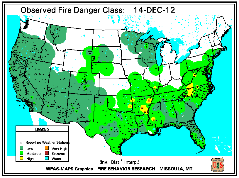
Persistent extreme drought conditions in eastern Oklahoma were conducive to wildfire activity throughout the month. In early December, the Indian Springs wildfire blazed at least 122 acres of hardwoods to the west of Spavinaw. At mid-month, several fires erupted along the border with Arkansas, with at least 8 large incidents burning on December 21st. The Peachland wildfire ignited on December 16th to the northwest of Talihina and consumed 450 acres. The Sonny Hollar wildfire scorched 350 acres southeast of Stilwell after sparking on December 19th. The remaining fires ranged between 100 and 200 acres apiece. In the final week of December, the Elk Trail wildfire burned 360 acres.
Arkansas
Wildfires continued in northwestern Arkansas during December. The Raspberry Mountain wildfire was ignited by lightning in the rugged, steep terrain near the Shady Lake Recreation Area. The blaze consumed over 870 acres of hardwoods from November 26th through December 17th until a series of rains extinguished its flames. Heavy smoke closed a portion of Highway 103 near Clarkson due to a 200-acre wildfire on December 14th.
Monthly Wildfire Conditions
Wildfire information and environmental conditions are provided by the National Interagency Fire Center (NIFC) and the U.S. Forest Service (USFS) Wildland Fire Assessment System (WFAS).
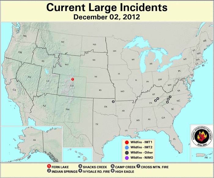
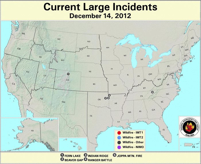
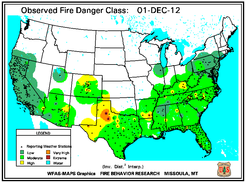
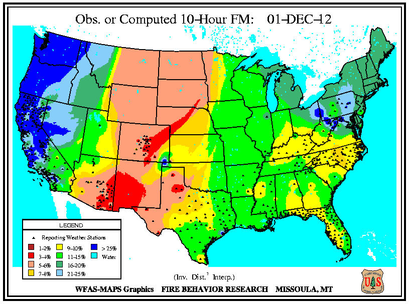
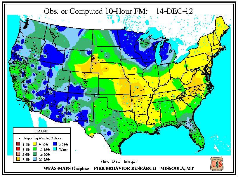
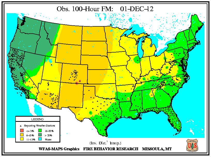
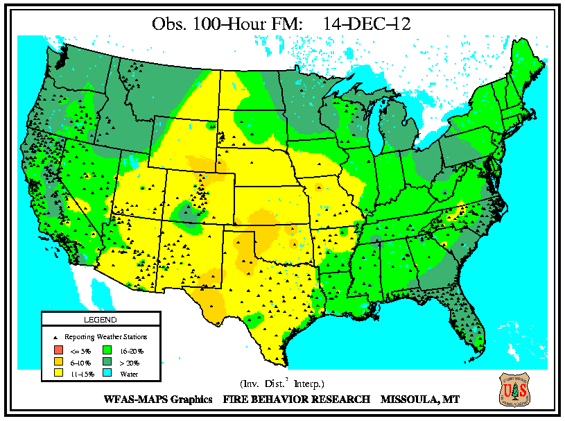
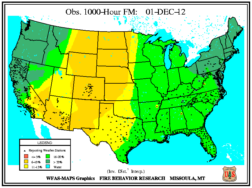
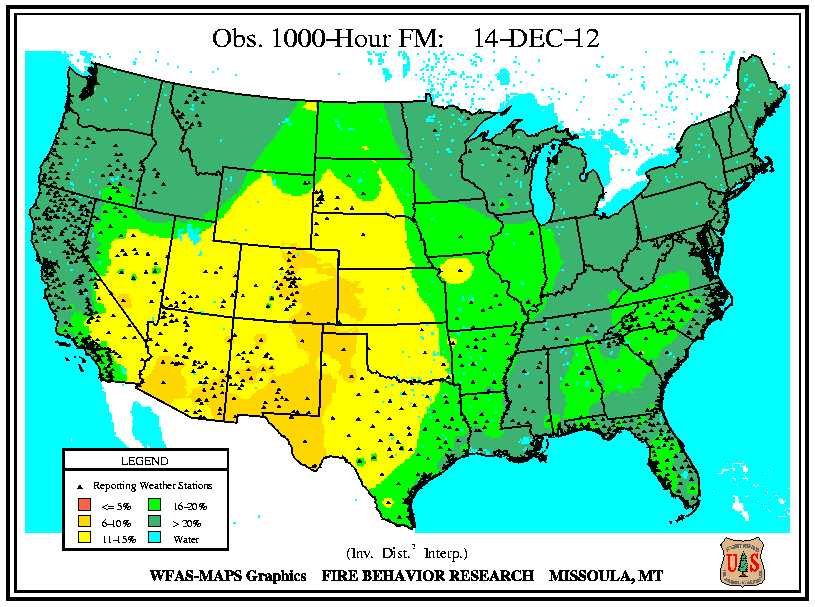
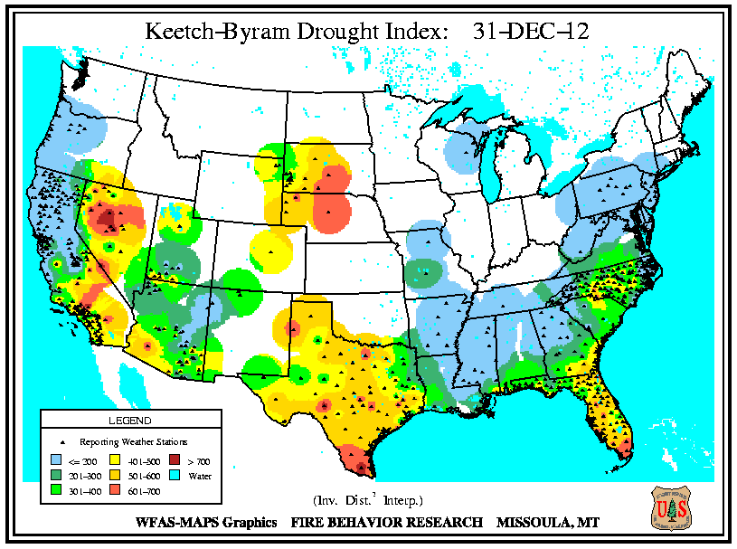
At the start of December, extremely low 10-hour fuel moistures (from 3 to 4 percent) existed in central Colorado, southwestern New Mexico and the southeastern corner of Arizona. Critical fire weather conditions (gusty winds, low humidity, warm temperatures) in southern California were aligned with high Keetch-Byram Drought Index (KBDI) values (> 600 units). Fuel moistures from 5 to 6 percent reached northward over the High Plains and Rockies. Wildfire incidents coincided with a pocket of low 10-hour fuel moistures (from 9 to 10 percent) in southwestern Virginia, near the Kentucky border. The Skegg Again wildfire charred over 820 acres of hardwoods on the Pine Mountain in Dickenson County of Virginia and threatened 18 homes. In Tennessee, the Shack's Creek wildfire consumed almost 1,000 acres, while the Cross Mountain wildfire blazed 100 acres. Utah and the areas from central Texas to the Great Lakes experienced low 100-hour fuel moistures (from 11 to 15 percent), while lower fuel moistures (from 6 to 10 percent) at both the 100-hour and 1000-hour intervals dominated the central Rockies, High Plains, northern and central Great Plains, and New Mexico. In northeastern Kansas, the Calfex Complex wildfire consumed over 6,200 acres in Riley County.
Central Arizona received precipitation ranging from 1.5 to 3.0 inches over several days at mid-month, which raised the 10-hour fuel moisture to above 25 percent. At both the 100-hour and 1000-hour intervals, fuel moistures increased across the High Plains and Southwest, although parts of Colorado, eastern Oklahoma, and west Texas remained at or below 10 percent. As more than a foot of snow dropped over northern Colorado on December 18th, the spread of the Fern Lake Fire was halted. Having burned since early October, the fire doubled its size in early December when high winds fanned the flames. Deep and dense duff combined with beetle-killed timber to fuel the fire, which consumed almost 3,500 acres in total. During December, the fire forced the evacuation of nearly 200 area residents and one cabin was lost. Critical fire weather existed along the Texas and New Mexico border as a result of a lack of moisture and unseasonably warm temperatures. Dry conditions in central Texas contributed to a sizable grass fire in Manor, which ignited on December 21st.
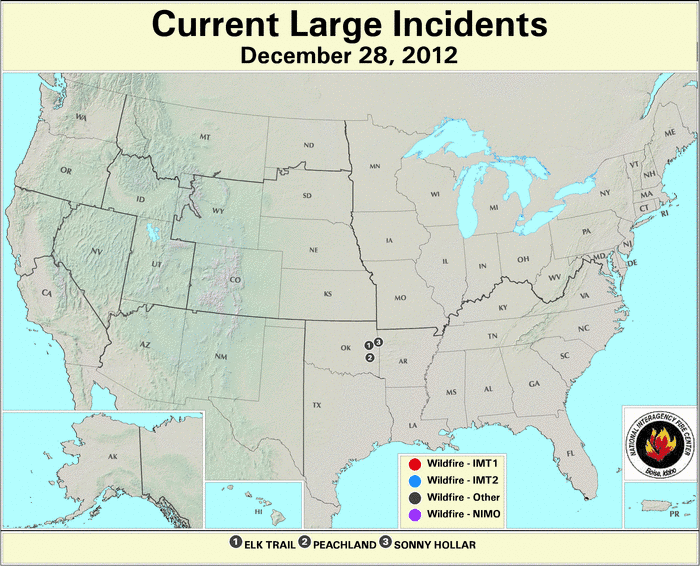
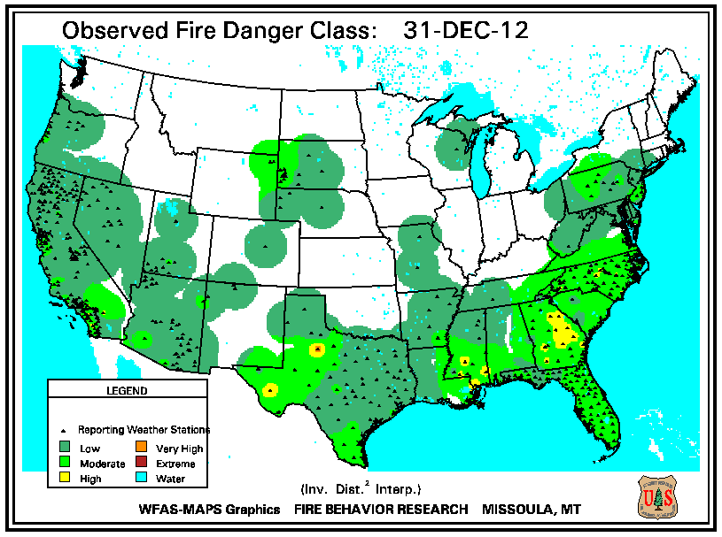
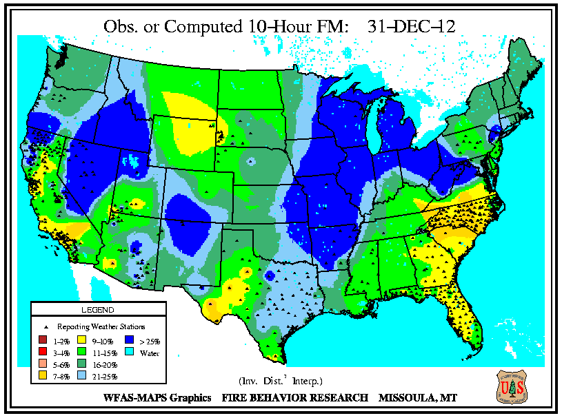
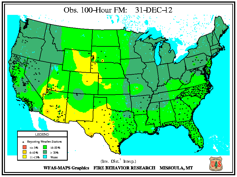
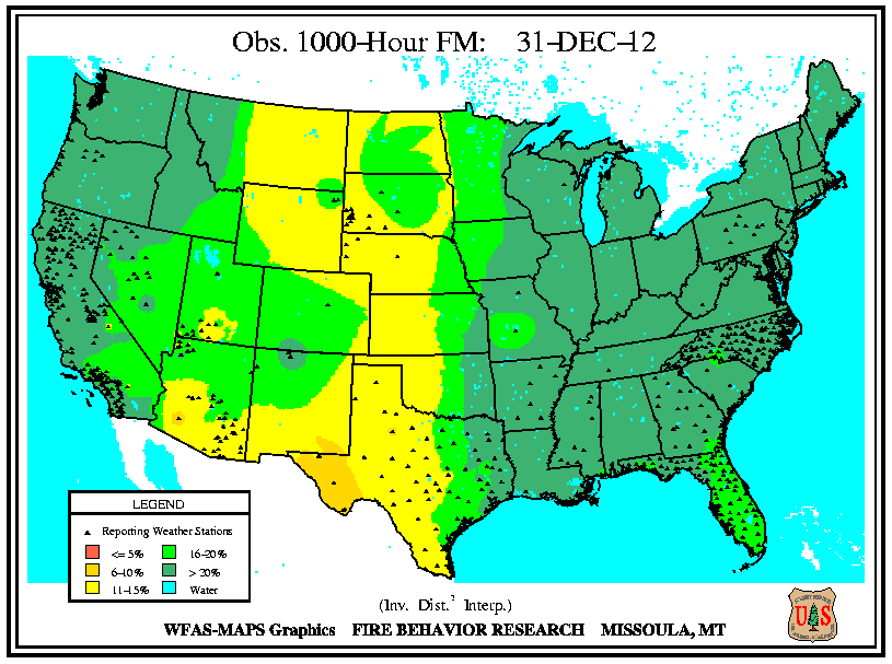
At month's end, the influx of precipitation resulted in fuel moistures at all intervals (10-hour, 100-hour, and 1000-hour) being at 6 percent or more for the entire country. At the 10-hour interval, fuel moistures in southern California and the central Carolinas were the lowest (from 7 to 8 percent) nationally. At the 1000-hour interval, only far west Texas' fuel moistures remained as lowest with values from 6 to 10 percent. The remaining large fires in Oklahoma were fully contained.