Updated: 7 November 2012
Overview
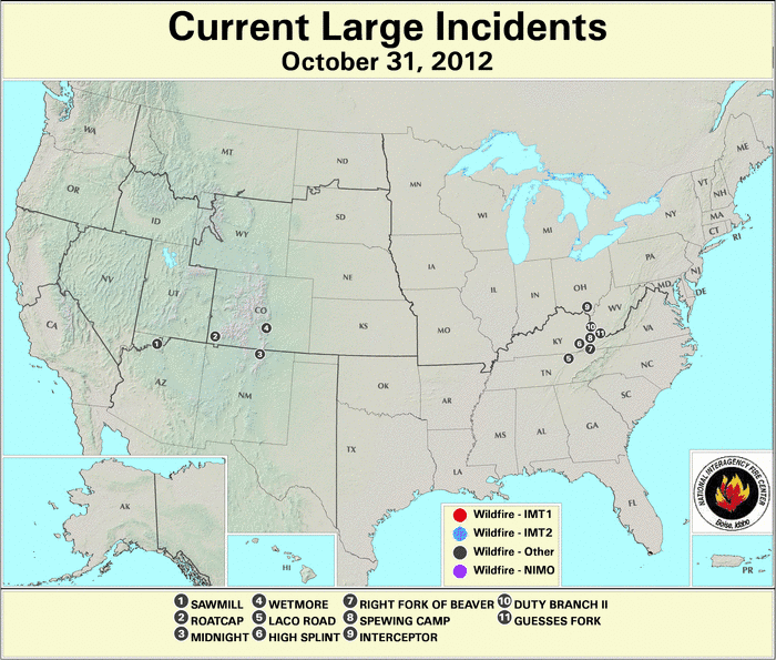
Large wildfires abated in the Pacific Northwest, and new fire incident locations transitioned from the northern Rockies into the central Rockies and High Plains during October. At the end of the month, a concentration of wildfires flared along the Cumberland Mountains in eastern Kentucky, northeastern Tennessee, and western Virginia (west side of the Appalachian Mountains).
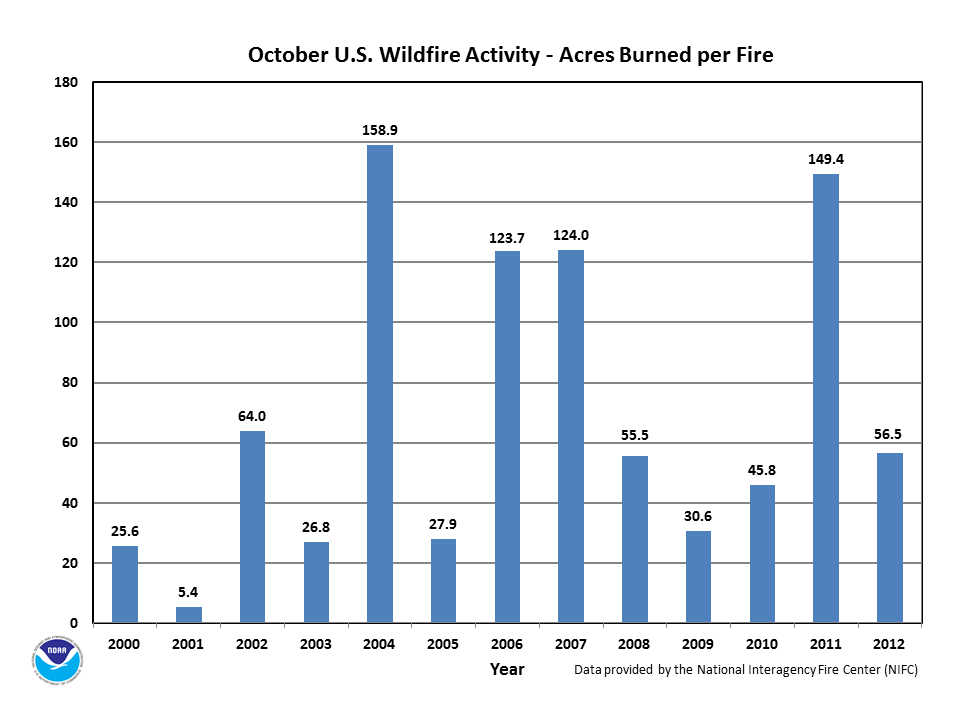
The monthly average fire size reached 56.5 acres per fire, which was the 6th highest for any October in the 2000-2012 record and slightly below the 10-year average of 66.3 acres per fire. However, the year-to-date fire size of 173.8 acres was the most since 2000 for any January through October period, and nearly twice the 10-year average (based on 2001-2010).
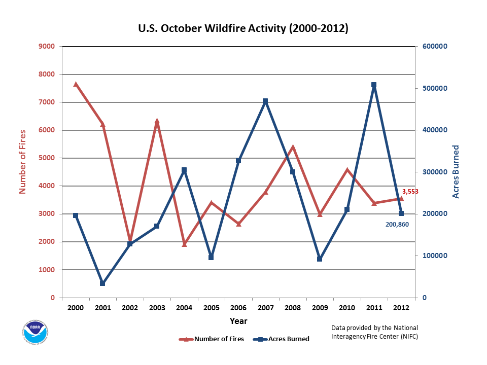
The October acreage burned represented about one-fifth the amount burned in September. The monthly total of 0.2 million acres burned by wildfires ranked at the median value (7th highest and 7th lowest) for any October since 2000, yet the year-to-date total acreage burned of 9.0 million acres was the 2nd highest since 2000. Notably, the year-to-date acreage burned in 2012 represents about 1.5 times the 10-year average (based on 2001-2010).
The number of October fires remained approximately equal to September's number. The monthly total number of 3,553 fires was the median value (7th least and 7th most) for October in the thirteen-year record. Yet, the year-to-date total of 51,811 fires was the least since 2000 for any January through October period and represented only three-quarters of the 10-year average number. Thus, despite the fire size in October being only one-fifth in size for roughly the same number of fires compared with the previous month, the year-to-date tendency of fewer fires (least) — but larger in size (most) — was preserved.
According to the National Interagency Fire Center (NIFC) :
For more wildfire statistics visit U.S. Wildfires.
Discussion
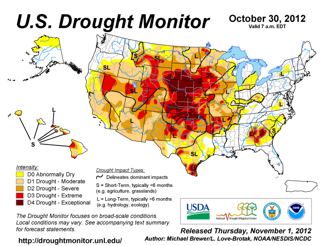
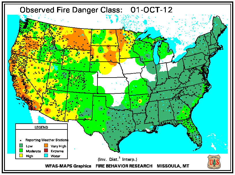
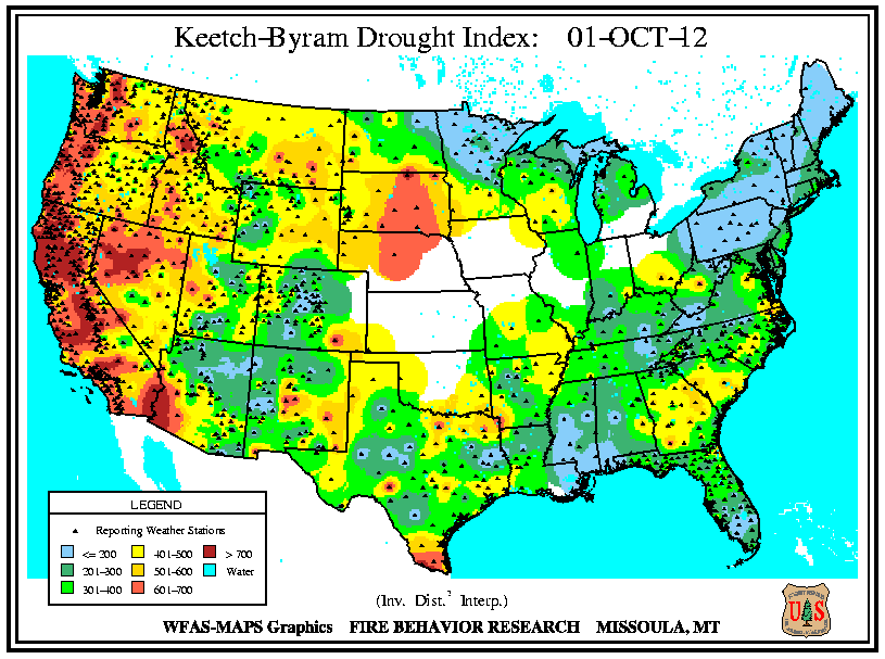
Throughout October, extreme drought (D3) and higher was concentrated over the central U.S., stretching east of the Rockies to the Mississippi Valley, according to the 30 October 2012 U.S. Drought Monitor. The significant moisture deficits (> 600 units) indicated by the Keetch-Byram Drought Index (KBDI) closely aligned with the extreme drought conditions across much of western and northern Nevada and exceptional drought (D4) in central South Dakota and Nebraska. These dry areas were the sites of wildfires during the month, with fire incidents occurring along the Nevada and Idaho border in early October, and incidents flaring in South Dakota and Nebraska at mid-month. For the January to October 2012 period, both Nebraska and Wyoming experienced their driest period on record since 1895, resulting in these states having the worst rangeland and pasture conditions within the United States. Severe drought (D2) expanded slightly in Arizona and New Mexico during late October, which coincided with an increase of wildfire occurrences across the Southwest. Please see the U.S. temperature and precipitation report for additional information.
Significant Events
Please note, this is a list of select fires that occurred during October. Additional fire information can be found through Inciweb.
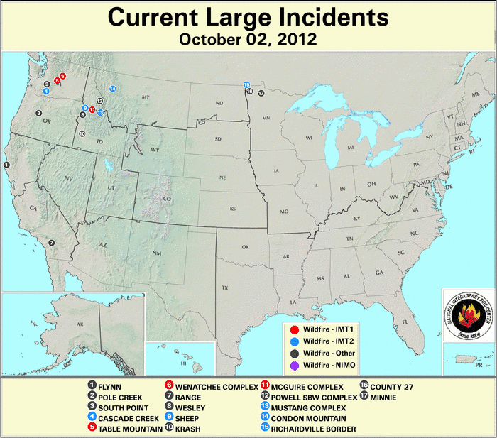
Idaho
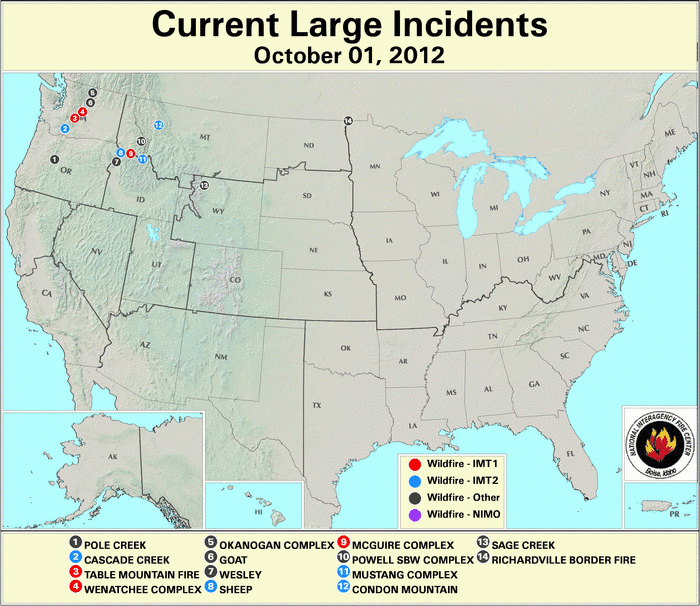
Low fuel moistures at all intervals (10-hour, 100-hour, and 1000-hour) and abnormally dry conditions through the first half of October, kept the wildfire danger elevated in central Idaho. The location of the Powell Selway-Bitterroot Wilderness Complex closely aligned with high KBDI moisture deficit values (> 700 units). The wildfire (comprised of three main and numerous small fires) consumed at least 67,000 acres of timber since being ignited by lightning in late July, including about 6,000 acres that burned during October in the Clearwater National Forest. The fire produced heavy smoke over northeastern Idaho and northwestern Montana, impacting air quality for residents. Rainfall of approximately 50 mm (2 inches) at mid-month aided in fire suppression efforts, which reached an estimated $4.8 million U.S. dollars. The Sheep Fire, a wildfire that originated during early September, consumed over 48,000 acres of brush, grass, and timber by mid-October, when rains helped impede the fire's spread. The blaze, which destroyed at least one commercial building at a mining camp in the fire's early stages, threatened logging operations and livestock in northwestern Idaho, according to media reports. The fire's estimated suppression costs topped $17 million U.S. dollars. Rain and snow toward the month's end doused the Wesley wildfire's flames. The fire burned 16,000 acres of subalpine fir in northwestern Idaho's steep terrain after being sparked by lightning in the previous month. Two firefighters received injuries while battling the blaze which threatened over 22 structures and a bridge. The fire's suppression efforts exceeded $14 million U.S. dollars.
Minnesota
Gusty winds fanned the Wannaska Complex, which consisted of at least eight wildfires in northwest Minnesota and burned over 30,000 acres during early October. Dryness and low humidity gave rise to extreme fire danger in the region, before rain and snow relieved the situation on October 4th. Fuels included timber, peat, grasses, swamps, and conifers. Peat is formed by decayed vegetation and contains trapped oxygen, allowing dry peat to smolder for long periods as it burns. Peat fires are difficult to extinguish, and limited the fire crews to a rate of about five acres per day in ending those incidents. Because the peat layer extended to 0.5 m (18 inches) in depth, the precipitation was not expected to fully snuff the peat fires, according to media reports. One of the larger fires, the County 27 wildfire, which burned over 4,700 acres of timber and grass in Kittson County, destroyed 11 homes, 24 other structures, and resulted in the evacuation of the town of Karlstad (over 750 residents). The largest incident, the North Minnie Fire near Red Lake charred nearly 25,000 acres of timber, grass, and peat in Beltrami County, resulting in the closure of area roads and trails near the town of Fourtown. One home and four outbuildings were destroyed in the town of Lancaster by the Richardville Border Fire as it burned about 1,000 acres of timber and grass in the nearby Canadian province of Manitoba.
Kentucky
In October, Kentucky braced for an active fire season based on the abundance of wildfire fuels coupled with dry conditions. Spring tornadoes left storm-damaged trees, summer brought little rain, and the autumn leaf drop increased the surface fuel layer throughout the Appalachian forests. Fourteen wildfires in 12 Kentucky counties were burning on October 26th. In Clay County, a wildfire grew to about 100 acres near the Sattler Branch community where firefighters applied water to the exterior of a home and prevented its loss to flames. In Estill County, a 50-acre fire produced haze for the town of Irvine. In Rowan County, a wildfire scorched about 75 acres in the steep terrain of the Daniel Boone National Forest to the east of Morehead State University. The fire threatened homes, barns, and power lines after jumping the containment line, while its thick smoke impacted visibility along the U.S. 60 highway. Meanwhile, a series of brush fires erupted along the borders of West Virginia and Ohio.
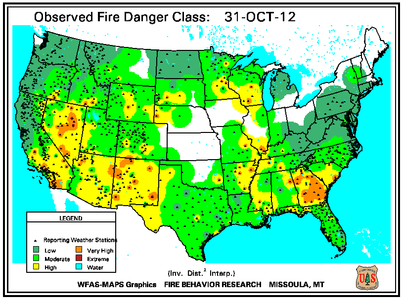
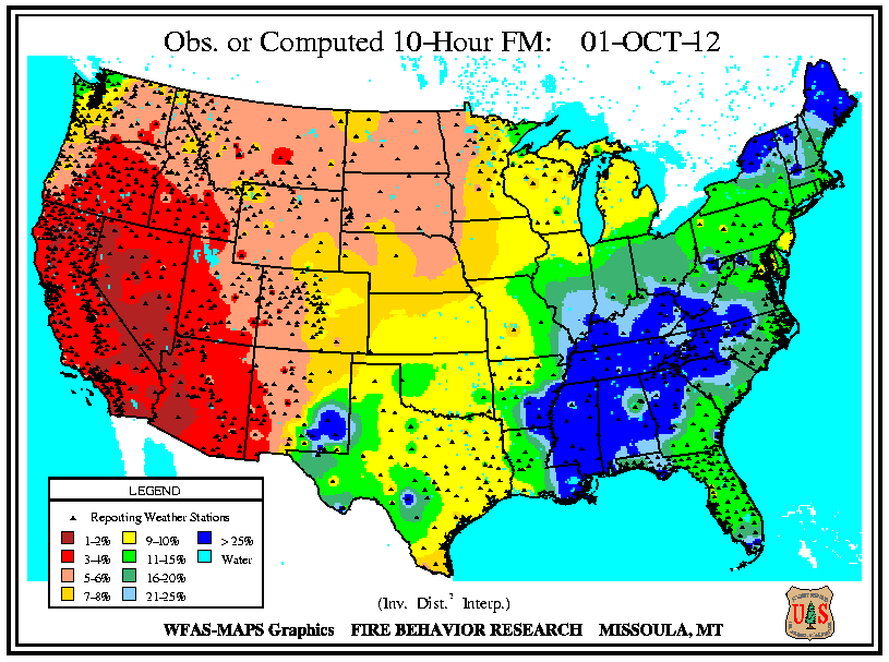
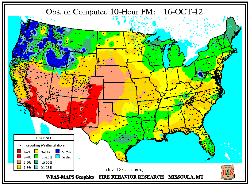
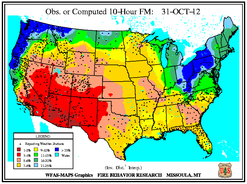
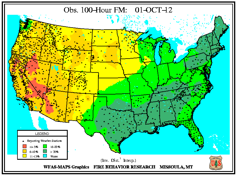
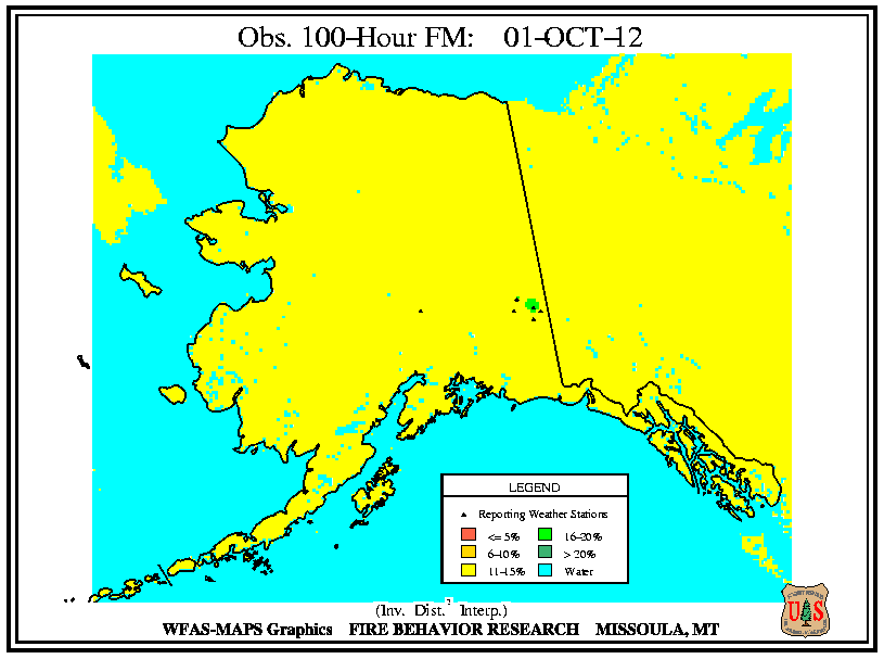
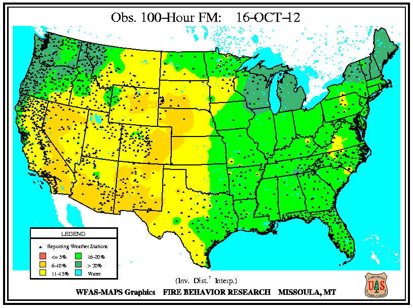
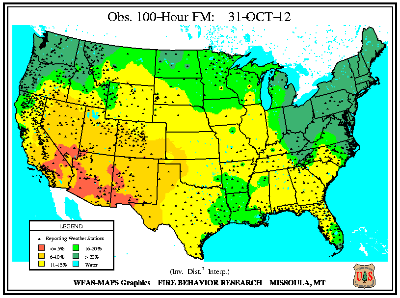
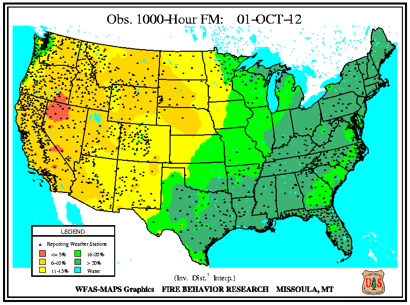
Monthly Wildfire Conditions
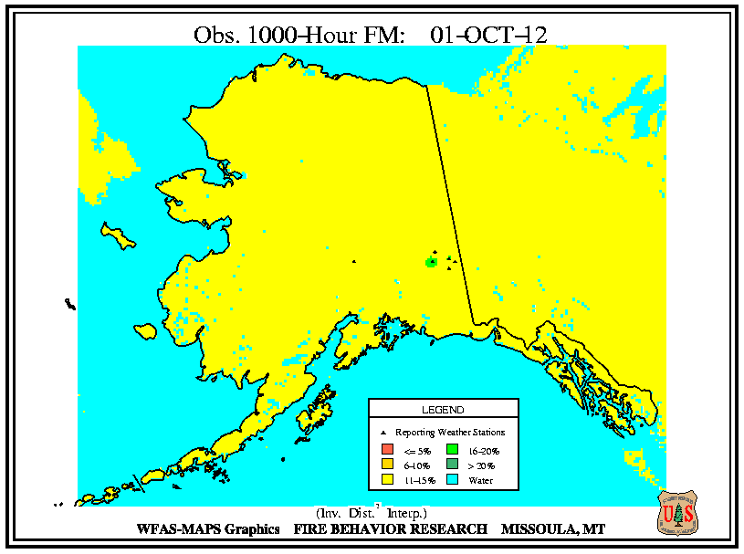
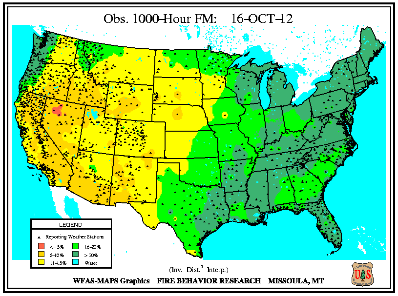
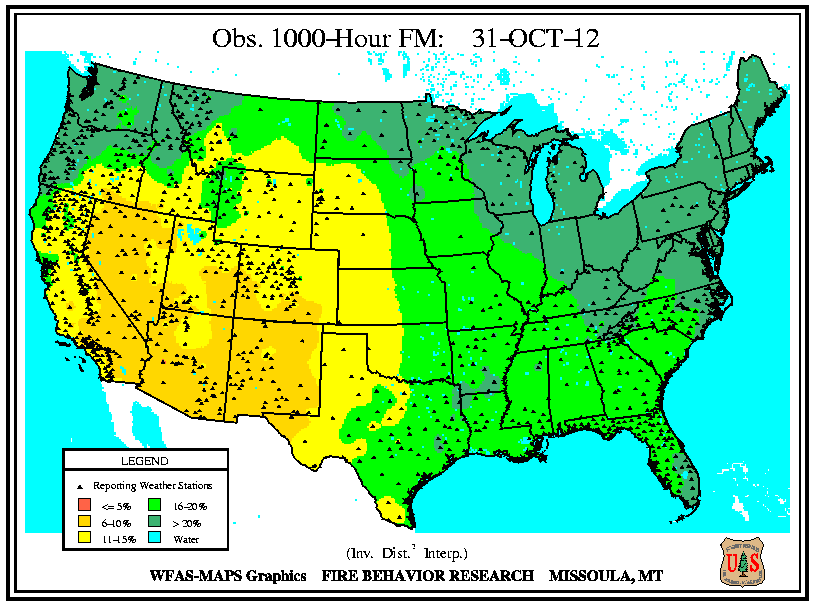
Wildfire information and environmental conditions are provided by the National Interagency Fire Center (NIFC) and the U.S. Forest Service (USFS) Wildland Fire Assessment System (WFAS).
Dry fuels and above normal temperatures fostered wildfire conditions in central Idaho and Washington, where numerous September fires continued to burn in October. Isolated incidents sparked in northern and southern California, as parts of the state experienced extremely low fuel moistures (below 6 percent) at all intervals (10-hour, 100-hour, and 1000-hour) early in the month. The Flynn wildfire, which sparked in northern California on October 1st, injured one person, destroyed one home and nine outbuildings, while threatening 70 other structures in Mendocino County, according to media reports. The fire scorched nearly 200 acres of commercial timber before being contained on October 4th and caused significant smoke across the Ukiah Valley and Lake County.
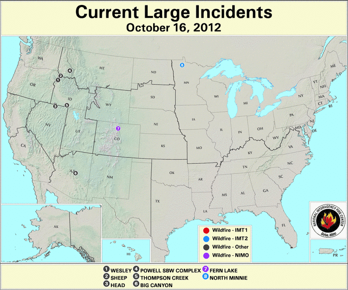
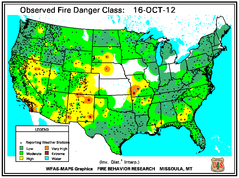
Low fuel moistures (below 10 percent at 100-hour interval) at mid-month aligned with wildfire incidents in central Arizona, northern Colorado, western Nebraska, and the southwestern corner of South Dakota. Arizona's Big Canyon wildfire was sparked by lightning on October 14th, forcing closure of trails in the Tonto National Forest. The fire scorched over 100 acres of chaparral and timber with grass understory near Payson, Arizona. In the southwestern corner of Colorado, the Vallecito wildfire ignited on October 12th, burned 600 acres in the San Juan National Forest during the month, and initially posed a threat to about 20 homes nearby. By early November the blaze grew by 400 acres, fueled by fallen leaves, dead Gambel oak brush, and dead ponderosa pine. In Colorado's Rocky Mountain National Park, the Fern Lake Fire consumed over 1,000 acres of beetle-killed lodgepole and ponderosa pines during October. An accumulation of thick duff existed in the Forest Canyon area where the last fire occurred in 1862, according to media reports. Despite a heavy, wet snowfall late in October of up to 100 mm (4 inches), the wildfire that ignited on October 9th continued smoldering at the month's end. The Crookston wildfire began in South Dakota on October 17th, but quickly crossed into Nebraska where the residents of Crookston were evacuated, and at least seven structures were severely damaged. Gusty winds spread the grass fire and forced a temporary closure along the U.S. 20 highway. Two additional wildfires in Nebraska burned about 4,000 acres around the same time.
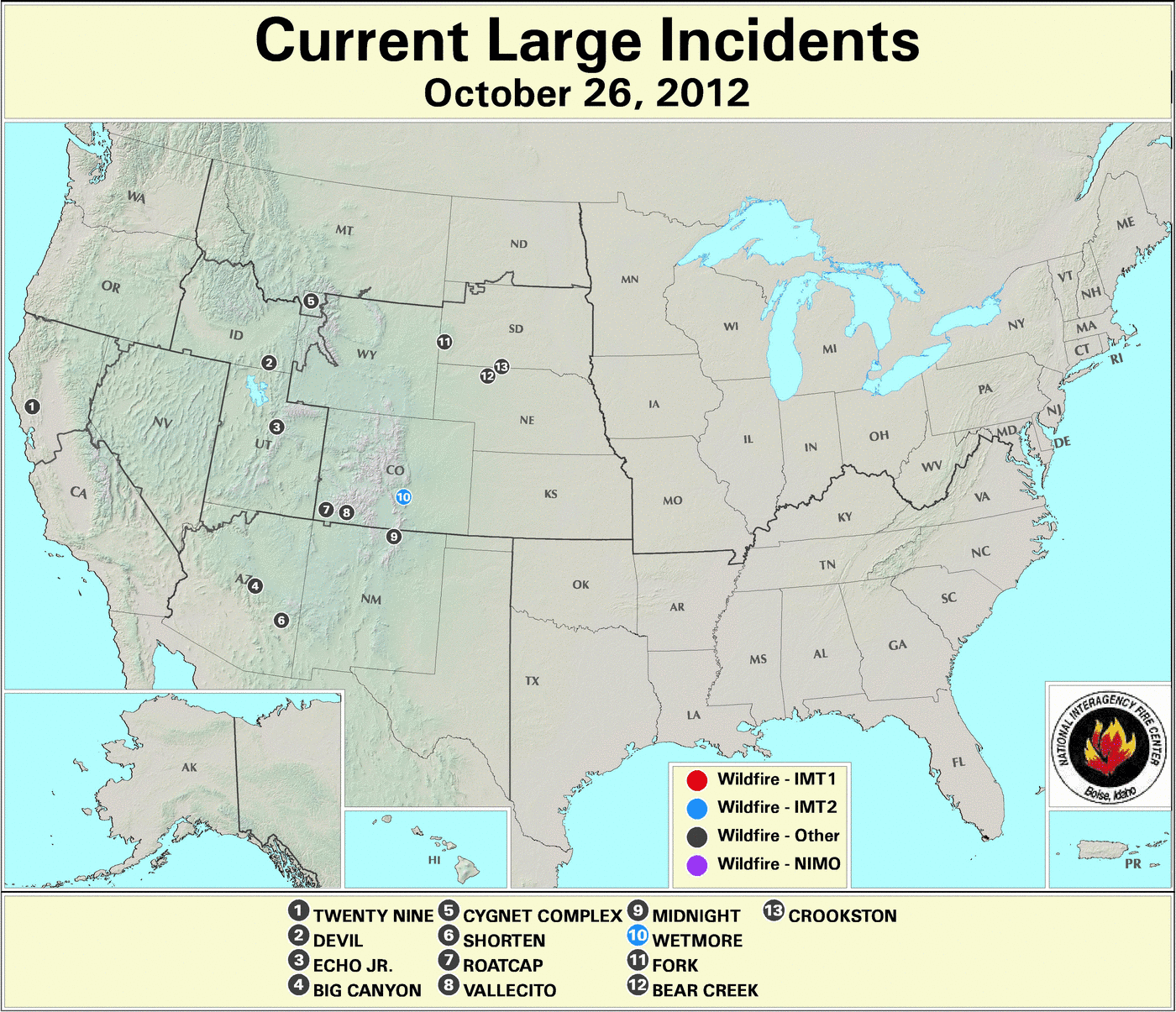
In the latter part of October, fuel moistures at the 100-hour and 1000-hour intervals lowered to below 10 percent across the southwestern states. Wildfire incidents in southern Colorado, northern New Mexico, and eastern Arizona were closely aligned with areas of extremely low 10-hour fuel moistures (below 5 percent). The Wetmore Fire ignited on October 23rd and destroyed 15 homes near Pueblo, Colorado. Strong winds fanned the wildfire, which consumed close to 2,000 acres of timber and grass, while forcing evacuation of nearly 400 residents. In southwestern Colorado, Roatcap Fire threatened around 100 homes and high voltage power lines near Dolores in Montezuma County on October 24th. The wildfire's flames charred over 400 acres of timber, piñon pine, and juniper. The Red Cross provided shelter and meals for residents of the 30 homes which were evacuated, according to media reports. In New Mexico's Carson National Forest, the Midnight wildfire sparked on October 23rd and burned over 360 acres of timber and grass east of Taos. Voluntary evacuations of two Valle Vidal campgrounds occurred as a precautionary measure. Light snow on October 26th, the onset of cooler temperatures, and higher humidity helped curb the wildfire. The Shorten wildfire remained active in southeastern Arizona, having scorched over 6,100 acres of juniper and ponderosa pine near San Carlos since September 25th. The Lookout wildfire near Santa Barbara in southern California threatened about 100 homes on October 17th, possibly sparked as a result of a downed power line. The fire burned over 40 acres of brush and forced brief evacuation of residents of Painted Cave.