| Contents Of This Report: |
 |

|

|
|
|
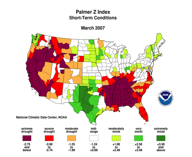
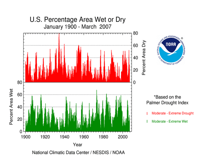
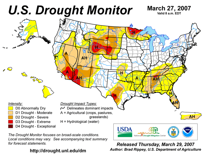
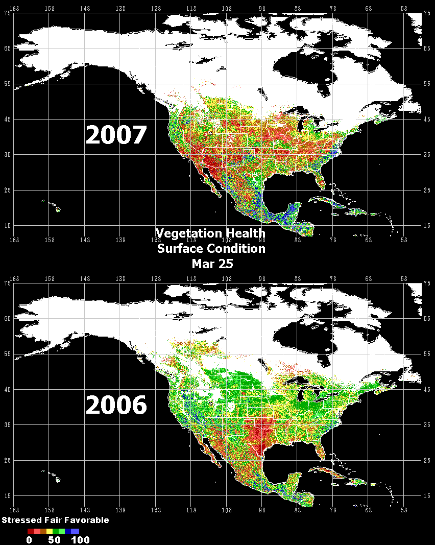
| At the end of March
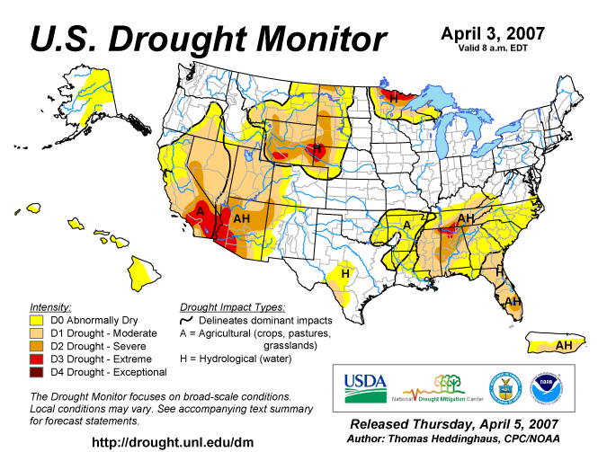
extreme drought was concentrated in the Southwest, southern Texas,
the western High Plains, northern Minnesota, and the Tennessee
Valley. Drought and abnormal dryness covered a broad swath from the
Southwest through the northwestern Plains into the upper Midwest,
as well as another swath from eastern Texas eastward to the
Atlantic Ocean (March 27 Drought
Monitor). Conditions in southern California and southwestern
Arizona continued to deteriorate. Los Angeles is on track to record
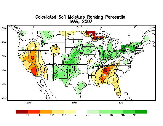
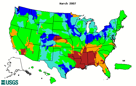
its driest rainy season in 120 years. A storm system at the end of the month brought much needed precipitation to the Plains and upper Midwest; persistent drought conditions were alleviated throughout the central part of the country. Drought and abnormal dryness continued in Florida and increased in severity in the central and southern Appalachians. In the Southwest, Southeast and upper Midwest, soil moisture was low. Vegetative health was stressed from central California southeastward through southern Arizona. Streamflow was low in a wide area of the Southeast.
|
Florida has had over 600
wildfires that consumed over 58,000 acres since the beginning of
the year. More acres have burned so far this year than in all of
2005. Burning bans are in effect in many areas of the State, water
restrictions are prevalent, and recreational uses of water bodies
have been reduced. In Texas drought has led to increased expansion and contraction of clay soils resulting in damages to house foundations. California farmers were affected by poor pastures and water shortages. Tennessee is under a statewide burning ban, and the Tennessee Valley Authority produced about 25 percent less electricity than usual because of low water levels and minimal rainfall. Farmers in Alabama reported that current drought conditions aided operations because the dry, broken soil made for excellent planting conditions. However, once the planting is completed, rainfall will be needed for crop growth. Impacts in drought-stricken areas have been collected and summarized by county at the National Drought Mitigation Center's Drought Impact Reporter. |
|
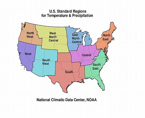
| A detailed review of
drought and moisture conditions is available for all contiguous U.S.
states, the nine standard regions, and
the nation (contiguous U.S.): STATES: REGIONS:
|
|
|
|
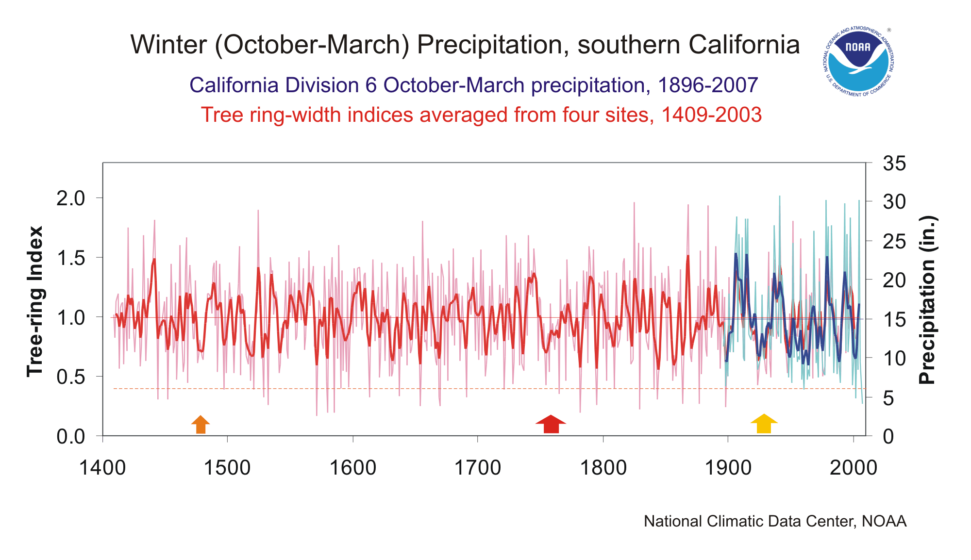
| In southern California, most of the annual precipitation falls in the 6-month cool season from October to March. After a string of dry winters in 1999-2004 was broken by very wet conditions in 2004-2005, severe drought conditions have returned to this region. In California Climate Division 6 (South Coast), which includes Los Angeles and San Diego, precipitation for the last six months was only 4.05 inches (28% of normal), the driest October-March period in the entire 112-year record. The U.S. Drought Monitor for late March and early April showed southern California classified from category D1 (moderate drought) to D3 (extreme drought), with rapidly worsening conditions since January. |
The graph below (annual values in light blue, 5-year weighted average in dark blue) shows the cool season (October-March) precipitation, 1896-2007, for California Division 6. The instrumental record is notable for extreme variability, with a six-fold difference between the driest and wettest winters. Long strings of dry winters (four or more consecutive years below average) are common, having occurred in 1896-1900, 1917-1921, 1923-26, 1928-1931, 1946-1951, 1974-77, 1987-1990, and 1999-2004. The period from 1917-1931 had below-average winter precipitation in 13 of 15 years (yellow arrow). |
 large image (50 KB) |
The graph to the left also shows a 595-year tree-ring record (1409-2003; annual values in light red; 5-year smoothed values in dark red) that corresponds very well to the variability in October-March precipitation. This record is the average of four blue oak tree-ring chronologies from central and south-central California. The correlation between the annual values of the tree-ring record and October-March precipitation is 0.858, which indicates a very high degree of shared variance. The tree-ring record captures the multi-year variability of the observed precipitation record extremely well. |
| The tree-ring record, as a proxy for winter precipitation, can put the droughts of the last century in southern California into a much longer perspective. Standing out is that the years with very low tree-ring values (index below 0.4; dashed orange line)--suggesting very low winter precipitation in those years--are much more numerous prior to 1900 (an average of five per century) than since 1900 (none). The winter of 2006-2007 may not be very unusual, relative to the nearly 600-year tree-ring record. |
| Also, the tree-ring record shows some persistent multi-year low-growth anomalies, suggesting that droughts in the past have been more sustained than those in the instrumental record. In the early 1500s, the tree-ring index was below the long-term mean for eight straight years (1515-1522; orange arrow). More strikingly, in the mid-1700s, two 7-year periods of below-mean tree growth (1751-1757, 1759-1765) are separated by a single year. The average tree-ring index for the entire 15-year period (1751-1765; red arrow) is very similar to that for 1917-1931, suggesting these events were of similar magnitude. |
| Overall, the multi-century tree-ring record strongly confirms the impression from the shorter instrumental record that drought is a recurrent feature of the southern California climate, whether severely dry single winters like this year's, or more persistent dry conditions. |
Resources:
|