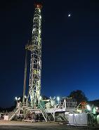
This dataset contains direct temperature measurements taken from boreholes drilled into the Earth's crust. These measurements can provide insight about past surface temperatures. Anomalies or departures from the geothermal gradient (measurements taken from deeper layers tend to be warmer) can be used to identify significant surface temperature changes in previous eras. A majority of the borehole data at the World Data Service for Paleoclimatology are from the University of Michigan's Global Database of Borehole Temperatures and Climate Reconstructions.

Accessing Data at the World Data Service for Paleoclimatology
Search Borehole Data
Search through borehole studies by investigator, title, location name, parameters, and latitude/longitude bounds.
Search All Paleoclimatology Data
Access a free text search of our entire archive.
Interactive Map
Select study locations by region, proximity to a point, or text-based attributes.
Google Earth Map
Locate and download borehole studies using a Google Earth map interface. Google Earth must be installed to use this search tool.
NCEI Paleo Web Service
Use the NCEI Paleo Web Service to access borehole study metadata records.
Browse Borehole Datasets
Contributing Data
To contribute to the borehole archive, review our instructions for contributing data. Prospective data providers can email paleo@noaa.gov to submit data and study description information. Data providers can also contribute to the University of Michigan Borehole database.


